
© 2011 Sabrina Swenson. All Rights Reserved.
Bolivia
Cli


")


January, 2011
Although Bolivia is the poorest country in South America, it is the richest in natural resources. My trip to Bolivia began with an early morning arrival into La Paz airport. La Paz, known for having the highest altitude International airport in the world at over 12,000 feet, is a small and pleasant airport in which to arrive. There were none of the usual mass amount of touts waiting outside of customs and immigration like there are in many touristy destinations all clamoring for business. They are usually either badgering you to see if you need a taxi or a hotel room. The shear number of these touts, their pushiness and volume is enough to annoy even the most patient of traveler. La Paz airport, by contrast, had none of this. I arrived into peace and quiet and enjoyed a coffee and hit the ATM before walking outside to find the exact minibus I was looking for right in front of me. I, and a large group of Bolivians smashed into the tiny minibus and for a whopping 4 Bolivianos (or .55 US cents) it dropped me off in the heart of downtown. I followed my map in the Lonely Planet guide book to a hotel I had chosen on the flight down. I generally don't book hotels in advance unless I'm arriving in the middle of the night (99% of the time this is not a problem). I checked in, went to my room and emptied everything from my backpack that I did not need for the day. With the pack significantly lighter, I headed out to see the city.
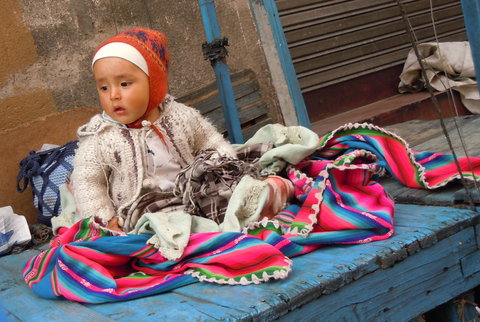
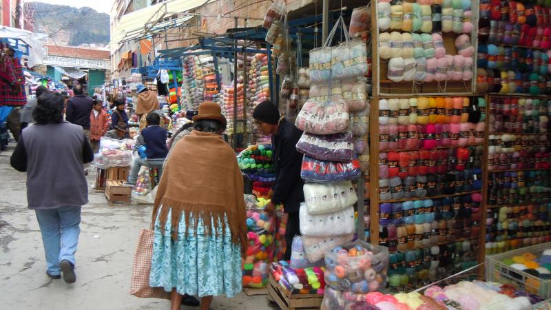
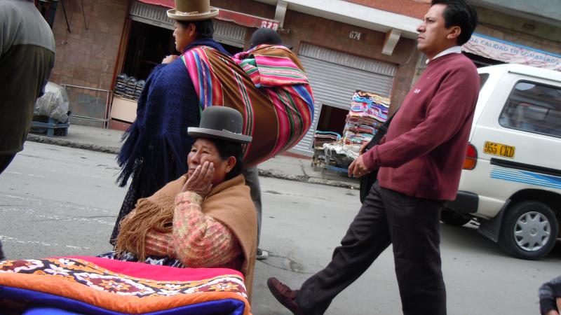
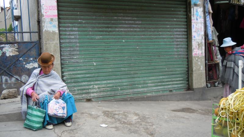
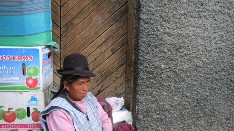
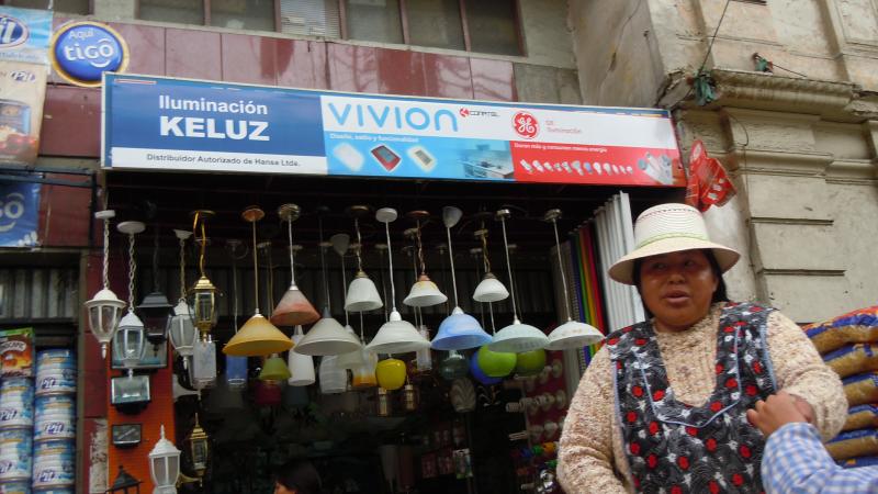
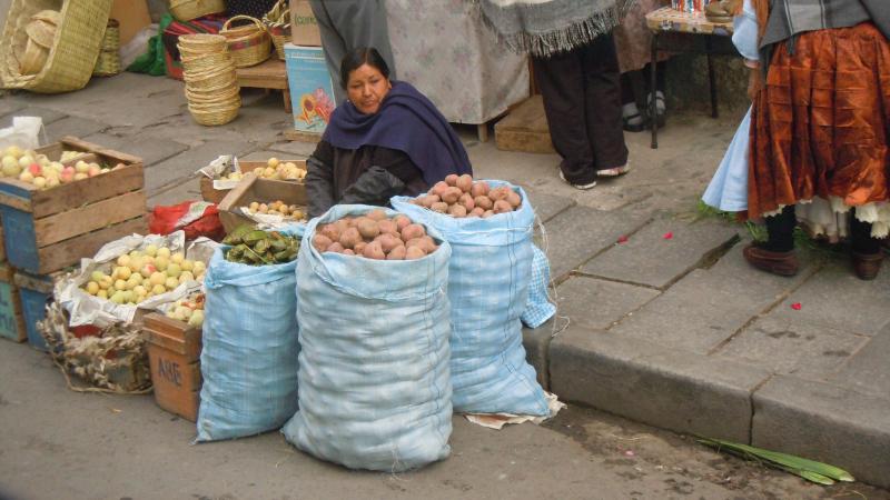
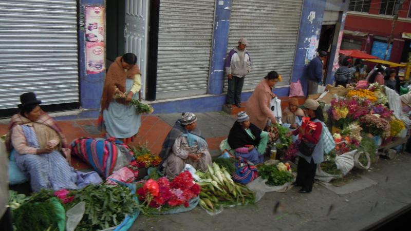
It's all but impossible to get lost in La Paz. The main street runs North and South and you always know which way to go because North is up the steep hill and South is down the steep hill. I meandered the streets and tried some of the fare for sale from the local street vendors. Saltenas (a pastry shell filled with meat) could be had for a few cents and was a delicious snack. While wandering around I noticed about half of the local women wearing the local traditional dress with the other half wearing modern clothing. The traditional dress for women in Bolivia starts with their long black straight hair being parted in the middle and braided into two sections. A sweater and sometimes shawl on the top, a frilly and flared skirt on the bottom all toped off with a small, round bowler type hat each looking as though it were two sizes too small. How this tiny hat stayed on their heads, I do not know.
By the end of the first day I was not felling well and immediately recognized the dreaded signs of altitude sickness. The next day I didn't do much as I felt awful. I took in only light food, lots of water and lots of sleep. By the morning of the third day I had aclimatised and felt much better.
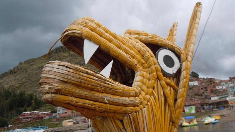
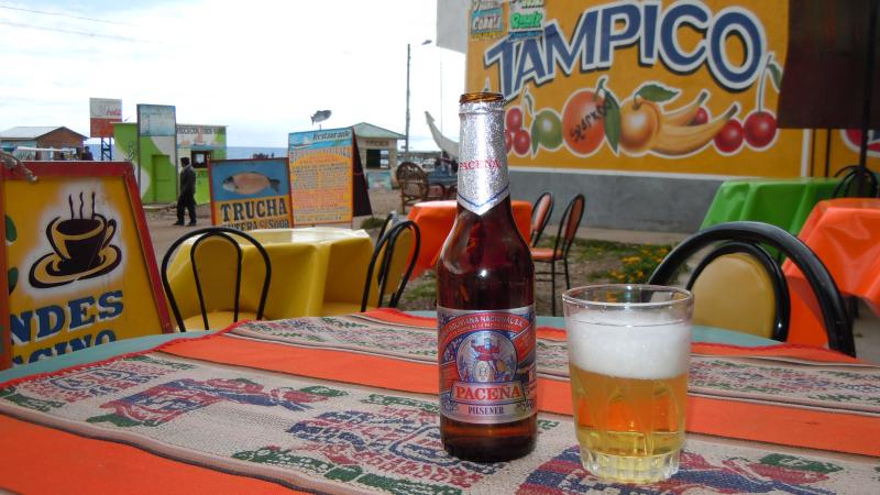
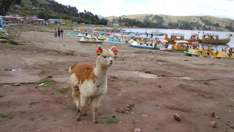
I hopped on a 3 1/2 hour bus to Copacabana (yes, like the Barry Manilow song although I don't believe this is the Copacabana he was talking about!). A beautiful little town on the shores of Lake Titicaca. Titicaca; the largest high altitude lake in the world, is a beautiful sapphire blue. It actually sparkles. The lake stratles both Bolivia and Peru. I took a traditional reed boat ride on the lake and later sampled some of the local trout. My book indicated some of the best in town was served from the local beachfront stalls. I walked past several until I found one that was full of locals (usually a sign that it is good). I ploped down and ordered a trout cooked in garlic and had a wonderful filet with a small salad, rice a few fries and a coke all for 20 Bolivianos or $2.79. All this with a fantastic view of Lake Titicaca to boot!
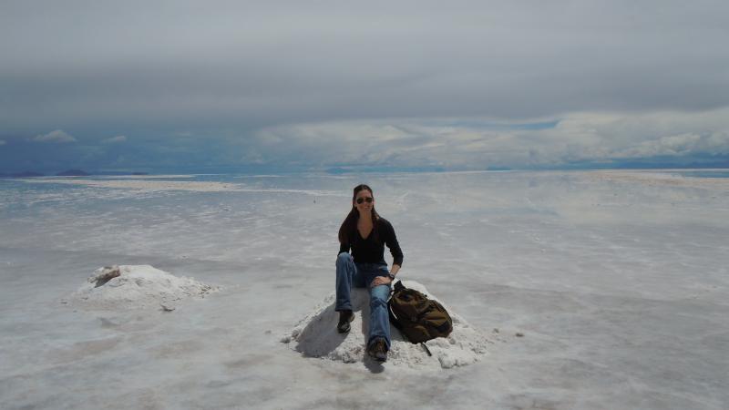
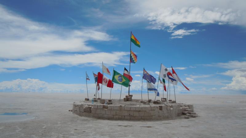
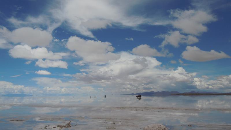
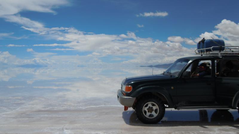
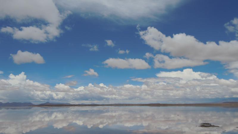
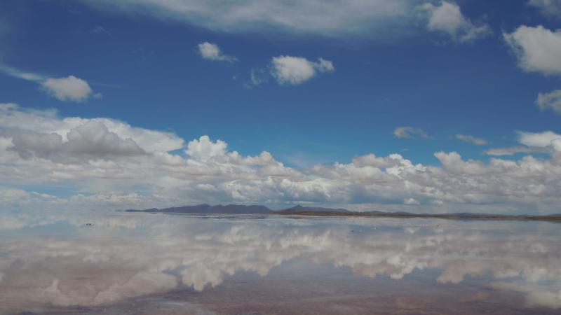
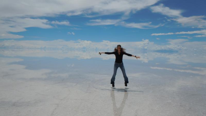
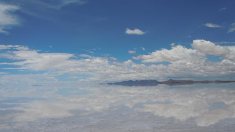
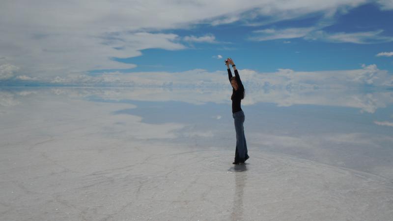
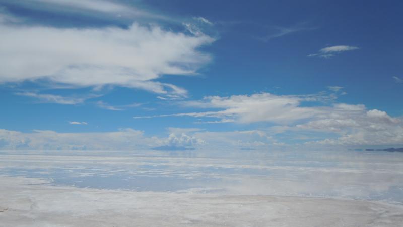
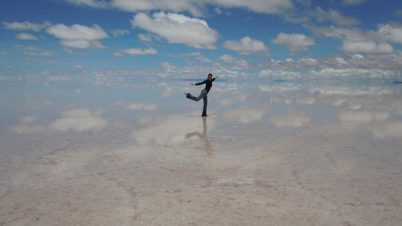
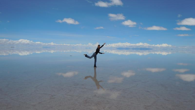
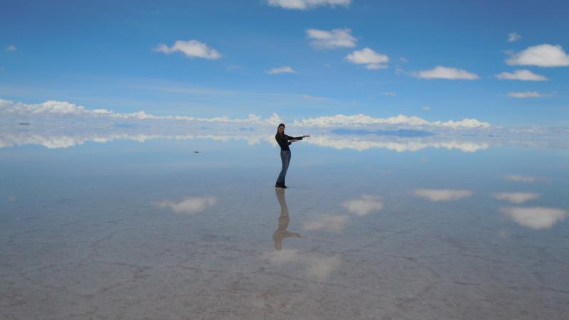
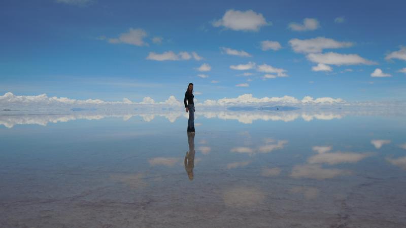
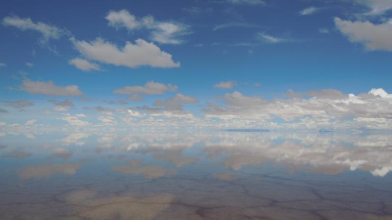
After a few days I eventually took a bus back to La Paz and arrived in time to catch an overnight bus to Uyuni in the South. The Salar de Uyuni (salt flat) is the reason I came to Bolivia. Last year I saw a picture of this incredible dream like landscape and decided I had to go. It's the world's largest salt flat at over 4,000 square miles. It is located in the Southwest of Bolivia and took 11 hours on a bus from La Paz to reach it. I arrived in the small town of Uyuni and after finding a hotel and leaving my stuff I found a tour to the Salar. I had been to a salt flat before in Ethiopia but this was different. Different because in the rainy season (which it was while I was there) if there is even a small amount of water on the salt flats it turns into the biggest reflecting mirror on the planet. The sky is perfectly mirrored on the water and it appears that you are truly walking in the clouds or on top of water! The first day I got a seat in a vehicle with five other people. We made a few stops and eventaully reached the Salar. The conditions were perfect and the sky was perfectly reflected in the water that was on the ground. It was as if the mind were playing tricks. We all got out and took lots of pictures of this unbelievable landscape. We eventually headed back the 45 minutes to town but I was so enamored with the place I decided to go again the next day. This time I hired a vehicle for myself and asked the driver to go straight to the Salar bypassing all the other stops. With his young 9 year old daughter in tow we headed to the salt flats. Although neither of them spoke English they were very kind and the daughter was most entertaining. People often ask how I have my picture taken if I travel solo...easy! Just ask someone! My driver was kind enough to take lots of pictures for me and after an hour or two we headed back to Uyuni. Unbelievably, there remains at least 10 billion tons of salt in the Salar de Uyuni. This place is one of earths greatest productions!
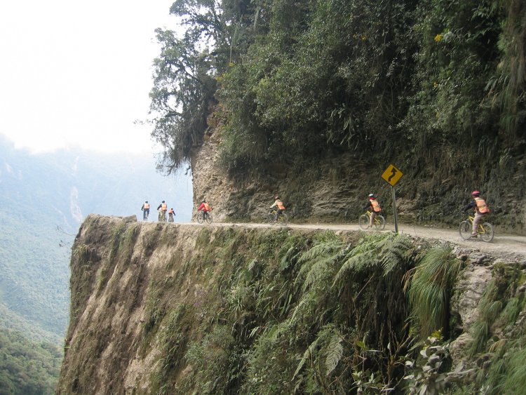
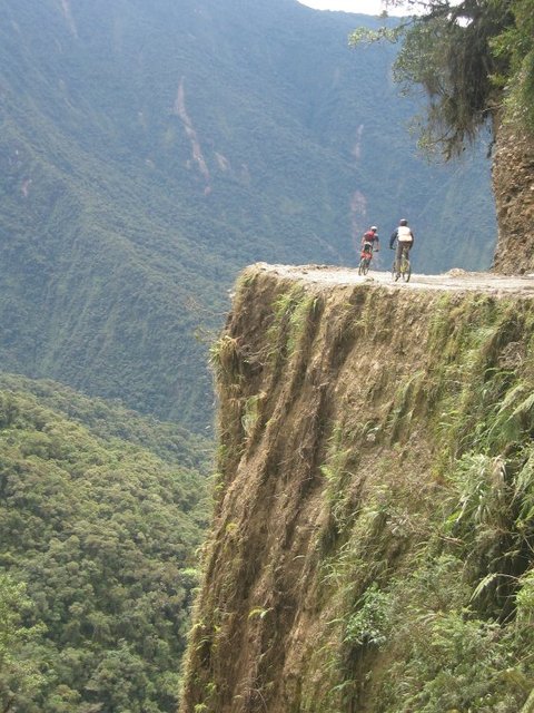
I eventually caught another night bus back to La Paz but because of more rain and bad roads we had to go 3 hours out of our way to get back for a total of 14 hours. I got another hotel in the city and after thoroughly reading up on the topic decided to mountain bike the world's most dangerous road (aka the death road) from La Cumbre at 15,419 feet to Yolosa at 3,937 feet. There were several different outfitters from which to pick for this ride however I thought it a good idea to go with a top notch one. This was one area I did not want to skimp on quality. As such, Gravity Assisted Mountain Biking company, run by a Kiwi was the top company recommended. Not only did they have top of the line mountain bikes, they were very well maintained and had the best bike brakes known to man. They also always have two guides. One guide a Bolivian local and the other a native English speaker. I thought it a good idea as you wanted to make sure there was no language barrier when given instruction on this road.
The world's most dangerous road was named such by an Inter-American development bank report, given the number of fatal accidents that have occured on it. An average of 26 vehicles were lost into the abyss on any given year. The worst in 1983 when a flatbed truck plunged over the edge killing the driver and 100 passengers. In 2007 a paved road was built on the opposite wall of the canyon, This means much of the traffic headed in this direction is now on the new road. The old road continues to be used, however, and I passed many vehicles on my descent down. Our guide indicating that the rules of the road simply were... whoever's bigger, goes first! That pretty much meant that everyone driving on the road was bigger than us.
We started the trip with a one hour drive from La Paz to La Cumbre where we suited up with our gear including helmets, googles, gloves, waterproof jacket and pants and of course, our pefectly fitted bikes. Once we were attired in our gear we started the ride with an approximate 4 mile ride down a winding paved highway so we could get used to our bikes. We stopped once for some pictures at a breathtaking view that looked as though we were in the Alps. We continued and then pulled over once again when we got to the actual world's most dangerous road (WMDR). The death road (precarious on a good day) is a 40 mile narrow gravel road about 10 1/2 feet wide with precipitous cliffs with up to 1,968 feeet drops, no safety barriers and oncoming traffic. All this coupled with the fact that it was raining and foggy and I wondered, could there be anymore variables against us?? Six people had signed up that day. A German couple, an English man, an Irish man, an Australian girl and me. It was a good mix and we all got along very well and although the day was mentaly taxing and tedious we all enjoyed the many stops along the road which gave us a chance to relax and chat as well as hear our American guide Phil give us instruction for the upcoming part of the road. Phil would tell us about upcoming possible debries, road obstructions such as the massive landslide in one area. He'd tell us about upcoming sharp 180 degree turns and other important need-to-know information. As anyone who plays sports will tell you, where the eye goes, the body follows. As such, we were instructed not to stare off into the abyss that was immediately on our left side as we would most likely end up there. Phil told about one lucky bicyclist who had actually gone off the death road but most fortunatly went off in an area that went down, flatened out a bit before continuing down a very long way. After driving off the road he hit most of the vegitation on the way down luckily stopping at the platform. After getting him back up to the road they asked him what happened. He replied he had been watching a butterfly. Phil said don't watch the animals! Concentrate on the road! In Bolivia cars drive on the right as they do in America so imagine my suprise when Phil said that the only exception to this rule is the death road and that we were to drive on the left and therefore closer to the edge. All of this coupled with the fact that it was raining and my googles kept fogging up made it sheer hell. Seeing was all but impossible so I finally tore off the googles and went without any eye protection hoping that no rocks would be kicked up into my eyeballs. The snaking road took us through two rivers and under a couple waterfalls. It was exhilarating, tedious and at times terrifying. We all, miraculous made it to the bottom. We did have one crash however as the German girl had quite a spill that sent her and her bike end over end. She was obviously shaken and banged up including road rash on her arms but after sitting a while she decided to carry on. We eventually reached the end of our 40 mile ride and it was heavenly to pull into the town of Yolosa. We were all smiles as we drove through town and ended our ride at the La Senda Verde animal refuge. We dropped our gear and were greated by an adult black spider monkey coming out to see what was going on. This sanctuary was built for homeless, abused and/or injured animals. It mostly consisted of dogs, monkeys and birds and it was a joy to walk around the sanctuary. We had a big lunch and then the Aussie girl and I went zip lining. Although I had done this before in Mexico, this zip line was huge by comparison. Although at the beginning of our journey on the death road it was early in the morning and at a high altitude so it was quite cold, however, by the time we got to the bottom it was actually a bit hot and humid. It was nice to cool off flying through the air on the zip line. After, we all got back on the bus for the 3 hour ride up the death road and back to La Paz. Now, not having to concentrate on the road, we were free to stare off and enjoy the scenery. I was kind of glad that I had not seen exactly how far this road drops off earlier on my way down on the bike. And thus ended another great trip! Bolivia get's a thumbs up from me. It is inexpensive, has unbelievably diverse scenery and lots of activities in which to participate!